Eleven hairpins, a 9% gradient, and snow walls still standing two metres above the roof of the car. The pass in late May is a different road from the one on the postcards.
Route
Åndalsnes → Valldal, Rv63
Hairpins
11
Gradient
9%
Summit
858 m
Typical opening
Mid-May to early June
The barrier at Sogge bridge came up on a Thursday. By Friday morning we were the fourth car of the season on the road, behind a delivery van, a county maintenance pickup and a man on a motorcycle who had clearly been waiting in Åndalsnes for a week to do exactly this.
What the clearing crews actually do
Trollstigen closes some time in October and does not reopen until the Norwegian Public Roads Administration has cut a channel through drifts that can reach eight or nine metres on the upper bends. The work takes several weeks. Rotary ploughs chew inward from both ends, then a survey team assesses the slopes above the road for cornices and hanging slabs; if the avalanche risk is judged too high, the opening slips regardless of how clear the tarmac looks.
The result, in the first days, is a corridor. On the fourth and fifth hairpins the walls stood well above the car on both sides, cut clean and blue-white at the edges where the plough had sliced them. You drive between them and see nothing but sky and snow until the road turns and the whole Isterdalen valley opens up beneath you.
The drive itself
From Åndalsnes the approach runs 15 kilometres up Isterdalen with the Trollveggen rock face — the tallest vertical wall in Europe, a kilometre of overhanging gneiss — on your right. The valley floor is flat farmland and then, abruptly, it is not: the road tips up and starts turning back on itself.
Eleven bends, each numbered and each with a stone retaining wall built by hand between 1928 and 1936. The bends are tight enough that a coach needs both lanes, which is the single most important thing to know about driving the pass. Meeting one on a blind hairpin is a reversing exercise. In opening week there are no coaches, which is the whole argument for going then.
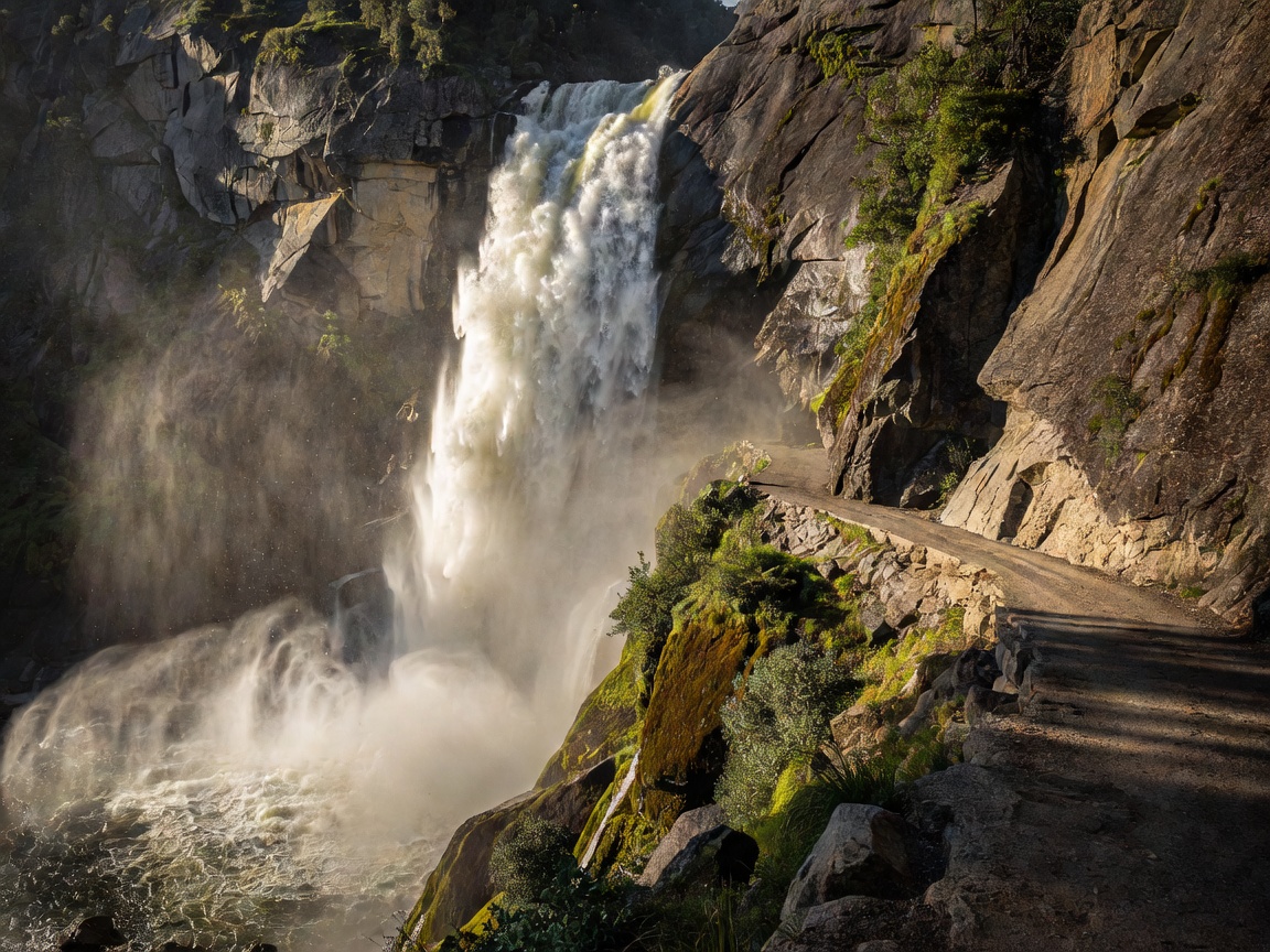
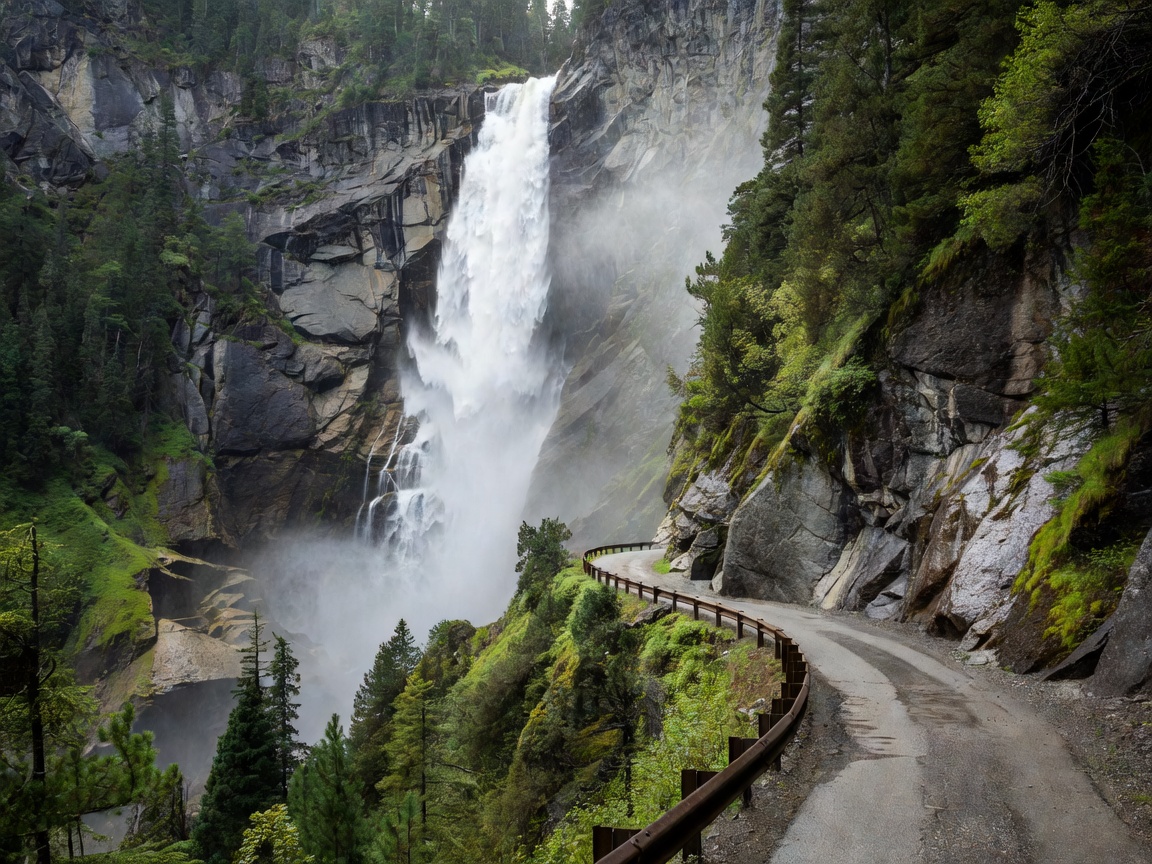
Halfway up, the Stigfossen waterfall drops 320 metres directly beside the road and across a bridge you cross at bend six. In late May, with snowmelt at full volume, it does not so much fall as detonate. The car was wet on the left side for the rest of the day.
Stigfossen at bend six. Peak volume is the first three weeks after opening.
At the top
The summit plateau at 858 metres holds the visitor centre and two architect-designed viewing platforms by Reiulf Ramstad, one of which cantilevers out over a 200-metre drop with a glass parapet and a floor that ends in nothing. In opening week the centre was still shuttered, the car park half snow, and the walkway to the platform ankle-deep in slush. Nobody minded. There were six of us up there in an hour.
By mid-July the same car park holds two hundred vehicles and the platform has a queue.
The pass is not difficult to drive. It is difficult to drive while looking at it. Stop at the marked lay-bys; there are enough of them, and using them is the difference between a memorable morning and a scraped wing mirror.
Timing the drive
Window
Conditions
Verdict
Opening week, 07:00–10:00
Snow walls, empty road, wet surfaces
The best version of this road
June, before 09:00
Full waterfall volume, light traffic
Excellent
July–August, 10:00–16:00
Coaches, campervans, full car park
Avoid if you have any choice
September, any time
Quiet again, autumn colour, closure risk rising
Very good; check road status
October onward
Usually closed
Do not plan around it
Practical notes
Check the road status the evening before. The Public Roads Administration publishes live open/closed information, and an opening can be reversed overnight after heavy snow.
Drive it uphill from Åndalsnes if you are nervous. Climbing, you are on the inside of every bend and you can see further.
Low gear on the descent. Nine per cent for five kilometres will cook brakes that are ridden the whole way down.
Fuel in Åndalsnes or Valldal. There is nothing on the pass.
Expect water on the road in the first weeks — meltwater runs across the tarmac in sheets on the upper bends.
Continue to Geiranger the same day via the Linge ferry and the Ørnevegen for twenty-two hairpins in one morning. See the Geirangerfjord file.
Would we do it again in opening week?
Yes, without hesitation, and we would accept the same trade-off: closed facilities, patchy weather, a wet car and the slight nervousness of driving between walls of snow. What you get in exchange is the road as a piece of engineering rather than as an attraction — a thing eleven times folded into a mountainside because there was no other way over.
The broader driving context, including tolls, ferries and the other seventeen National Scenic Routes, is in our road trips guide. If you want it inside a full week, it forms day seven of Fjords in Seven Days.